The Backgrounds of The Chinese Maps: Their Reading and Understanding Public Lecture Series – Dr. Isabelle Charleux: “Representing the Sino-Mongol Frontier in the Late Qing Period From a Mongol Perspective (Mongol Banner Map, 1907, HKUST)”
Co-organized by Institute of Chinese Studies, The Chinese University of Hong Kong, École française d'Extrême-Orient, and The Hong Kong University of Science and Technology Library
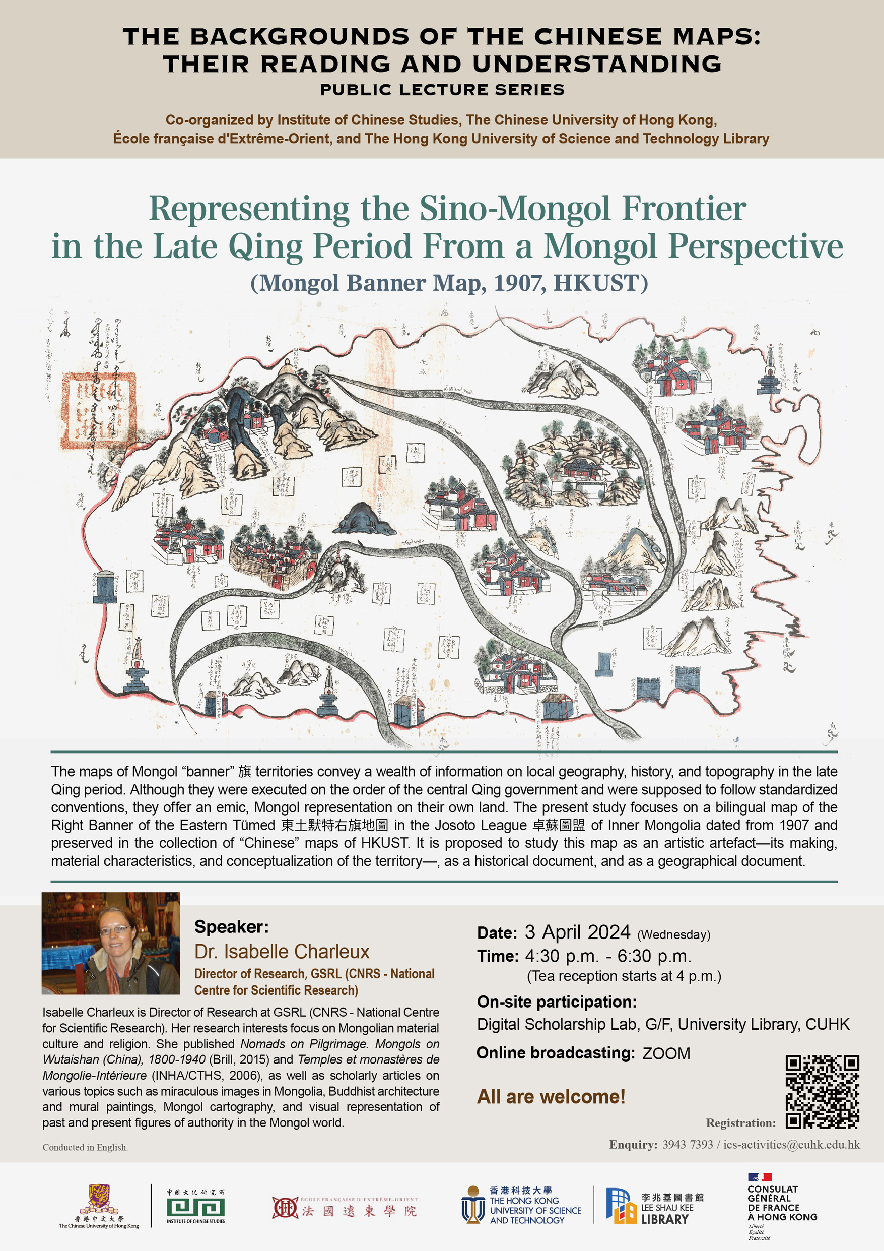
The maps of Mongol “banner” 旗 territories convey a wealth of information on local geography, history, and topography in the late Qing period. Although they were executed on the order of the central Qing government and were supposed to follow standardized conventions, they offer an emic, Mongol representation on their own land. The present study focuses on a bilingual map of the Right Banner of the Eastern Tümed東土默特右旗地圖 in the Josoto League 卓蘇圖盟 of Inner Mongolia dated from 1907 and preserved in the collection of “Chinese” maps of HKUST. It is proposed to study this map as an artistic artefact—its making, material characteristics, and conceptualization of the territory—, as a historical document, and as a geographical document.
Speaker:
Dr. Isabelle Charleux is director of research at GSRL (CNRS - National Centre for Scientific Research). Her research interests focus on Mongolian material culture and religion. She published Nomads on Pilgrimage. Mongols on Wutaishan (China), 1800-1940 (Brill, 2015) and Temples et monastères de Mongolie-Intérieure (INHA/CTHS, 2006), as well as scholarly articles on various topics such as miraculous images in Mongolia, Buddhist architecture and mural paintings, Mongol cartography, and visual representation of past and present figures of authority in the Mongol world.
Date:3 April 2024 (Wednesday)
Time:4:30 p.m. - 6:30 p.m. (Tea reception starts at 4 p.m.)
On-site participation: Digital Scholarship Lab, G/F, University Library, CUHK
Online broadcasting: ZOOM
Online Registration: Click here
Language: Conducted in English.
All are welcome!
Enquiries: 3943 7393 /